Geothermal Exploration
Our geophysical surveys help reveal what’s happening beneath the surface in a non-invasive way. Zonge provides imaging techniques to identify hot fluids, clays, brines, sinters, and geologic structures that are key to finding and developing geothermal resources. By combining them, we give you a reliable picture of the subsurface, helping reduce risk and guide smarter decisions from the start.
Geothermal
| Deposit / Method | Magnetic | Gravity | CSAMT/AMT | MT | IP | EM |
|---|
Geothermal Project Experience
Newberry Volcano, Oregon
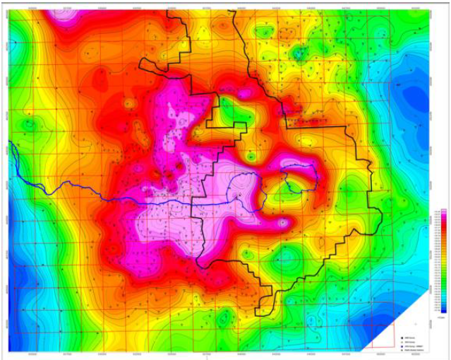
Zonge International conducted gravity surveys at Newberry Volcano in 2007 and 2010 for Davenport Newberry, followed by a magnetotelluric (MT) survey in 2011. The combined interpretation drew on more than 100 MT stations from the 2006 and 2011 surveys, together with gravity data and drill-hole lithology, to refine the subsurface model and evaluate the area’s hydrothermal potential.
Read the 2013 Stanford Geothermal Workshop paper, The Evolving Role of MT in Geothermal Exploration at Newberry Volcano, Oregon (PDF, 1.1 MB).
Steptoe Valley, Nevada
As part of a Sandia National Laboratories-led geothermal research project, Zonge International conducted a combined 40-station MT and CSEM survey and processed the resulting data in northern Steptoe Valley, Nevada. The public overview presents the broader investigation and its findings: Geophysical Imaging at Steptoe Valley, Nevada.
Selected Research and Awards
The following independent and agency sources document Zonge fieldwork, instrumentation, or research support.
- Gravity survey at the Granite Mountain geothermal system, Nevada — 51st Stanford Geothermal Workshop, Feb 2026
- DOE SBIR award for airborne drone EM in geothermal exploration — U.S. Department of Energy, 2024
- Gravity survey at the Grover Point blind geothermal system, Nevada — 49th Stanford Geothermal Workshop, Feb 2024
- ZEN and ANT-4 field acquisition at San Emidio, Nevada — 45th Stanford Geothermal Workshop, Feb 2020
Related Survey Methods
Explore UAV magnetic surveys, gravity, CSAMT, MT/AMT, and induced polarization.